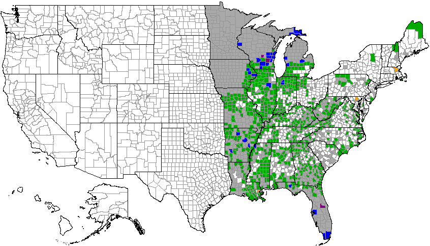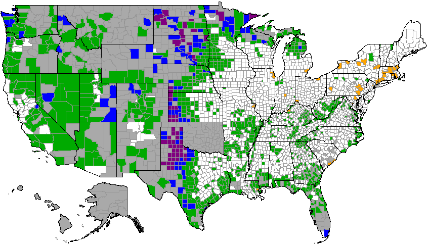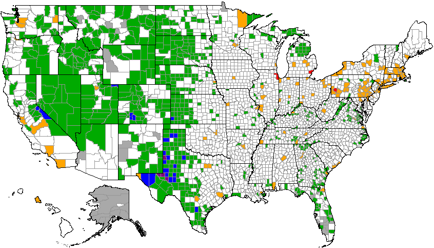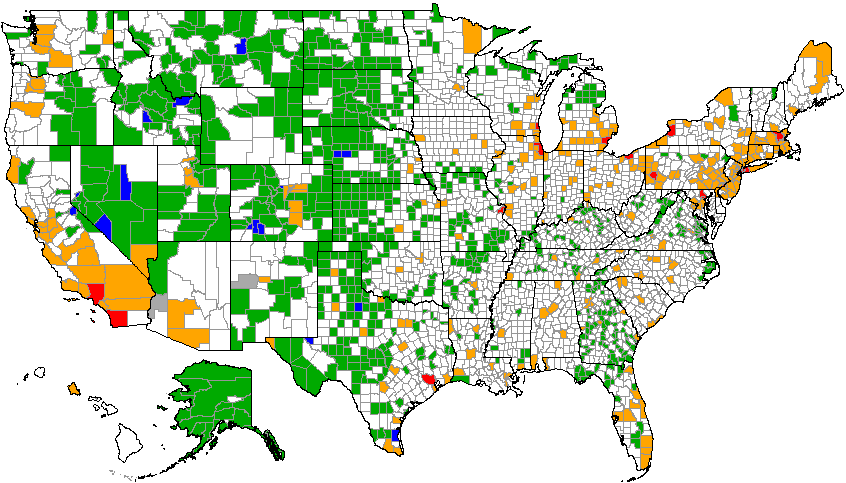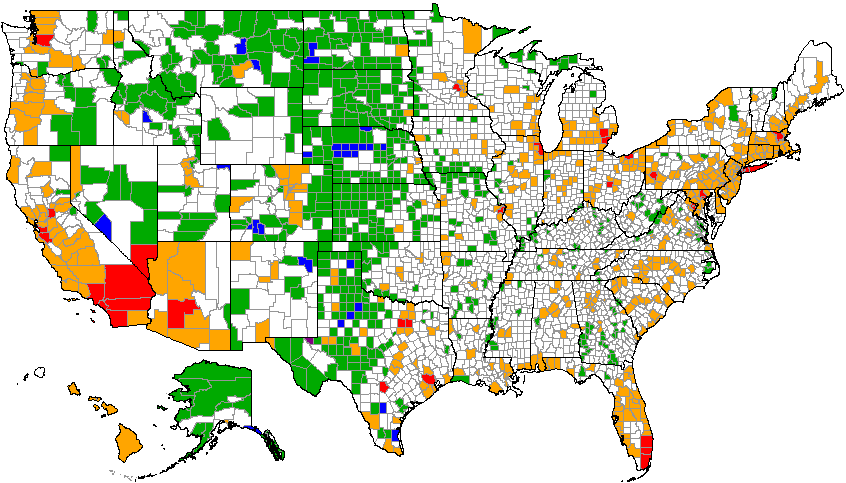
What I've done here is take a modern county outline map of the United States (counties as of 1983-2001) and plotted on it population ranges at forty-year intervals from 1800 to 2000, using color codes, to enable the viewer to see patterns of population growth in the U.S. at county-level resolution. (Note: I do not have the software to create any more such maps. The pictures here are screenshots of maps I created at a now-defunct user-enabled county-travel website.)
County boundaries have changed often, especially before about 1925. To plot these on a modern map, I have applied the population of historical counties in the following ways: 1) When a historical county included the area of two or more modern counties, I have coded the single modern county that most closely represents the population base or historical descendant of the historical county (usually but not always the county bearing the same name) and greyed out the others; 2) When two or more historical counties have been folded into one modern county (example: in 1932 Fulton County, Georgia, annexed the adjacent Milton and Campbell Counties), I have coded the combined population of all the relevant counties; 3) Lesser boundary changes have been ignored.
The exception to this is independent cities that have been detached from their parent county, primarily in Virginia but also including Baltimore, Maryland, and St. Louis, Missouri. To mark geographic units at this level would be to use a different type of geographic patterning than prevails elsewhere in the country. This would result in misleading coding, as what would look at this map scale like one county would actually be two, the city and the rump county, which separately might code at a lower level than they would combined. Accordingly, all such independent city/rump county pairs have been coded as single entities with combined population.
The coding is by orders of magnitude, as follows:
Sources: Population figures are from the U.S. census. The invaluable Map Guide to the U.S. Federal Censuses, 1790-1920 by William Thorndale and William Dollarhide (Genealogical Pub. Co., 1987) was used to correlate historical counties with modern ones.